


2018 School Spending Survey Report
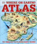
Where on Earth? Atlas
160p. glossary. illus. index. maps. notes. DK. Mar. 2017. Tr $19.99. ISBN 9781465458643.
COPY ISBN
VERDICT While this volume is certainly extremely useful for students writing reports, browsers will also enjoy perusing the fascinating tidbits interspersed throughout.–Margaret Nunes, Gwinnett County Public Library, GA
ALREADY A SUBSCRIBER? LOG IN
We are currently offering this content for free. Sign up now to activate your personal profile, where you can save articles for future viewing
ALREADY A SUBSCRIBER? LOG IN
Thank you for visiting.
We’ve noticed you are using a private browser. To continue, please log in or create an account.
Be the first reader to comment.
Comment Policy:
Comment should not be empty !!!