


2018 School Spending Survey Report
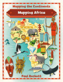
Mapping Africa
9780778726128.
ea vol: illus. by Mark Ruffle. 32p. (Mapping the Continents). chart. glossary. index. maps. photos. Crabtree. Aug. 2016. lib. ed. $27.60. pap. $8.95. ebk. $41.40.
COPY ISBN
ALREADY A SUBSCRIBER? LOG IN
We are currently offering this content for free. Sign up now to activate your personal profile, where you can save articles for future viewing
ALREADY A SUBSCRIBER? LOG IN
Thank you for visiting.
We’ve noticed you are using a private browser. To continue, please log in or create an account.

Be the first reader to comment.
Comment Policy:
Comment should not be empty !!!